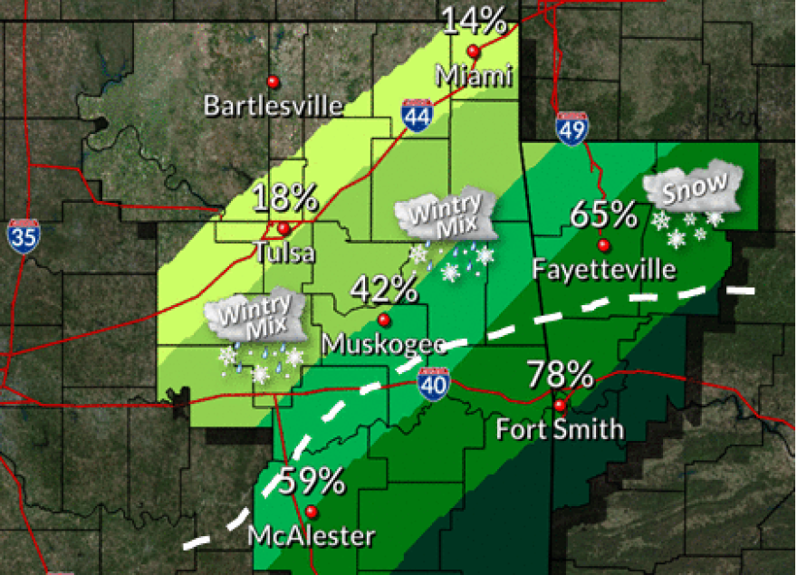
A strong cold front will enter northeast Oklahoma after midnight
as surge into northwest Arkansas and southeast Oklahoma toward
daybreak. Light precipitation is expected both ahead and behind
the boundary, with few thunderstorms possible later tonight
across southeast Oklahoma and west central Arkansas.


As colder air filters south, a light wintry mix may develop
Monday morning across parts of northeast Oklahoma. This wintry
mix will shift farther south and east by the afternoon, and
may changeover to all light snow across northwest Arkansas
before tapering off late in the day. Some light accumulations
will be possible, mainly for parts of northwest Arkansas.


Near record low temperatures will be possible by Tuesday morning,
with moderating temperatures expected by mid to late week.
Tulsa Weather: A Change is Going to Come

NWS-Graphic

